/homepage/webp/homepage-splash-mobile-compress.webp)


.png)


.png)
Measure Land Emissions and Removals
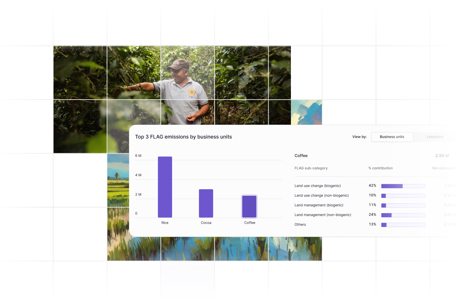
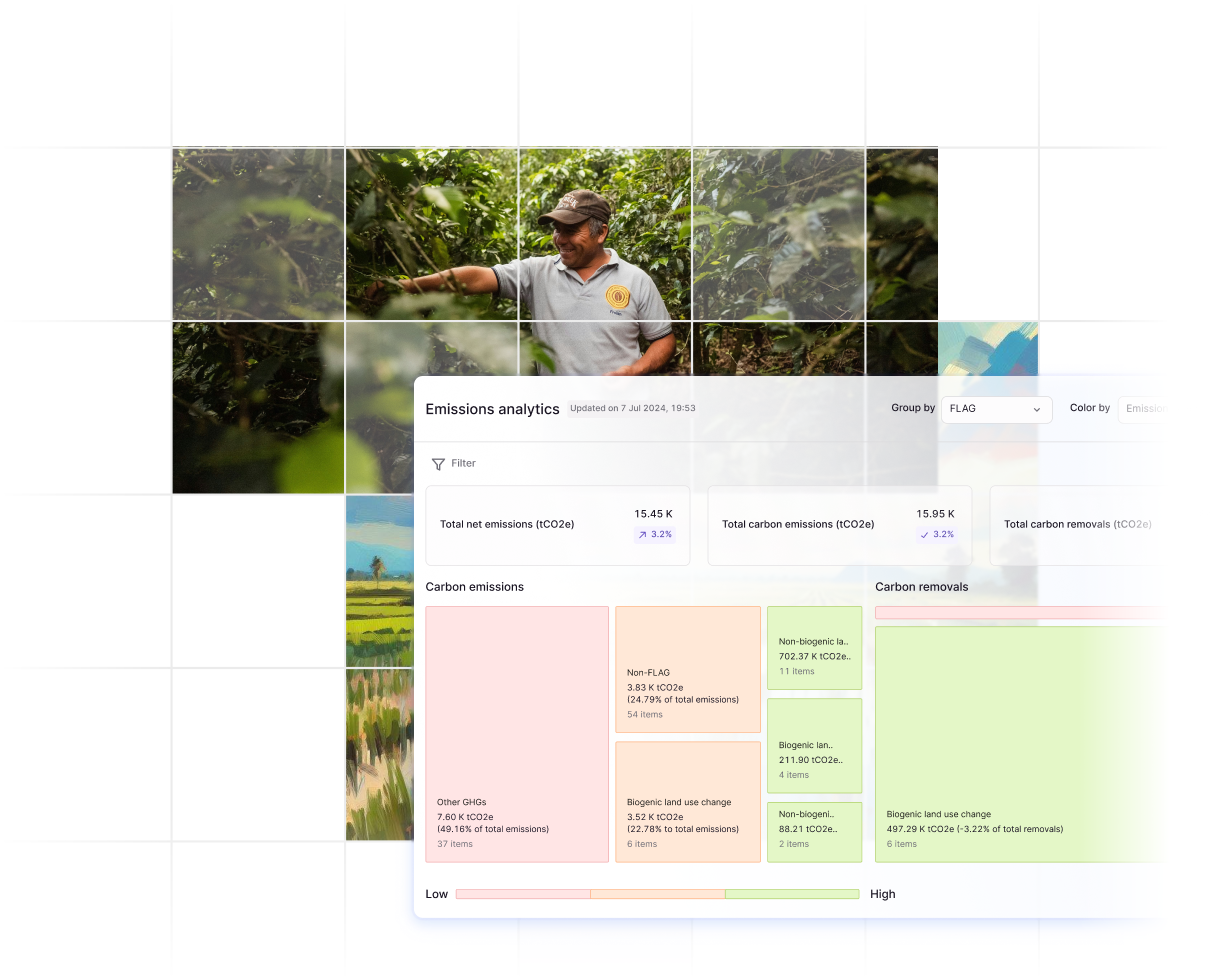
Calculate land use change over the required 20-year lookback period, and land management emissions from activities such as fertiliser application, farm activities, livestock rearing and more.

Determine FLAG Eligibility
Review your industry, operational, and value chain model to determine FLAG exposure, the need for SBTi FLAG targets, and then align to the appropriate reporting pathway.

Streamline FLAG & SBTi Submission
Swiftly prepare for FLAG reporting and Science Based Targets initiative (SBTi) validation, ensuring efficient and accurate compliant submissions.

Speed Up Assurance & Validation
Enhance transparency in FLAG methodologies with an audit-ready trail of FLAG calculation data, simplifying validation by the SBTi and other regulatory bodies.